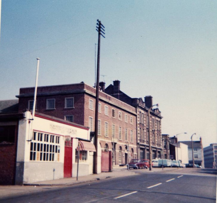
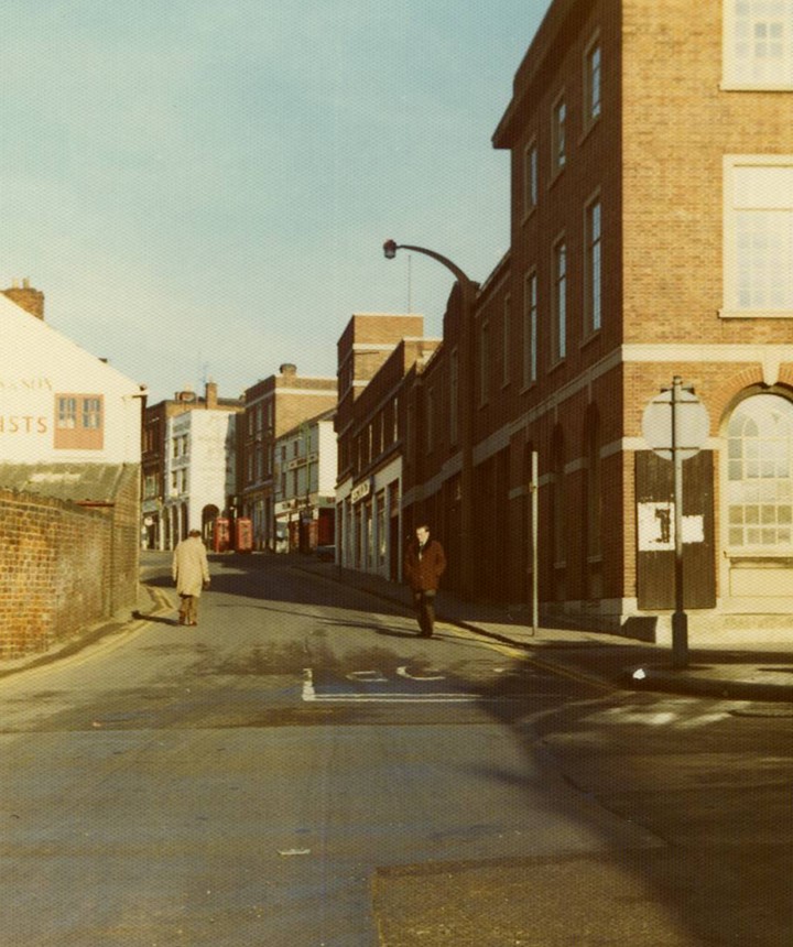
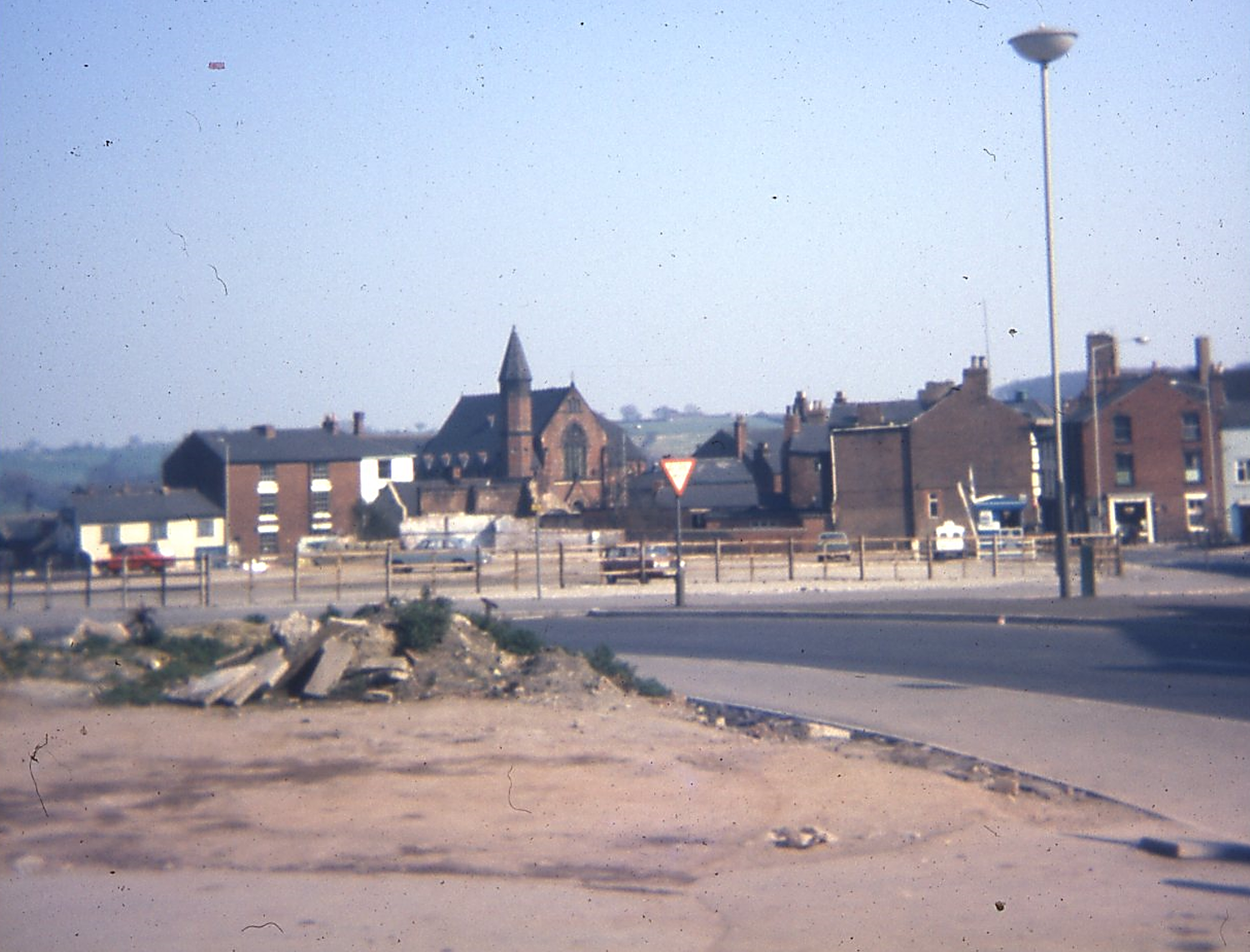
On this page you’ll find images of Chesterfield that we’ve published on our Facebook page, or have been able to include here with the permission of some of those who have given talks to us.
They are not in any real order, but we hope you’ll enjoy this peep into Chesterfield’s past. This page is picture heavy so may take some time to load.
If you are using images from this website you should credit this site as the source. Photographs here must not be used or reproduced for commercial purposes. Please be aware that this does not imply that further copyright issues do not apply to images and information on this site. For further details see our social media and website policy. Thank you.
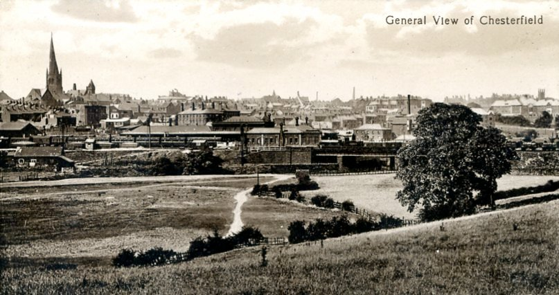
In August 2022 we updated our Facebook page header to this a general view of Chesterfield looking from Tapton. It’s from a, possibly, late Edwardian postcard.
To left is the familiar ‘Crooked Spire’ and tower of Chesterfield Parish Church. To the far right is the tower of Holy Trinity Church. Between them is a bustling town, which has seen many changes since this image was taken, not least the former Midland Railway station to the centre of the image – which has seen two replacement station buildings since the 1870s building and is, of course, still operational.
You might also make out the buildings of the former Station Hotel, to the centre left, demolished in August 2022.
A town much changed, but thankfully with a much healthier population, improved sanitary and housing conditions.
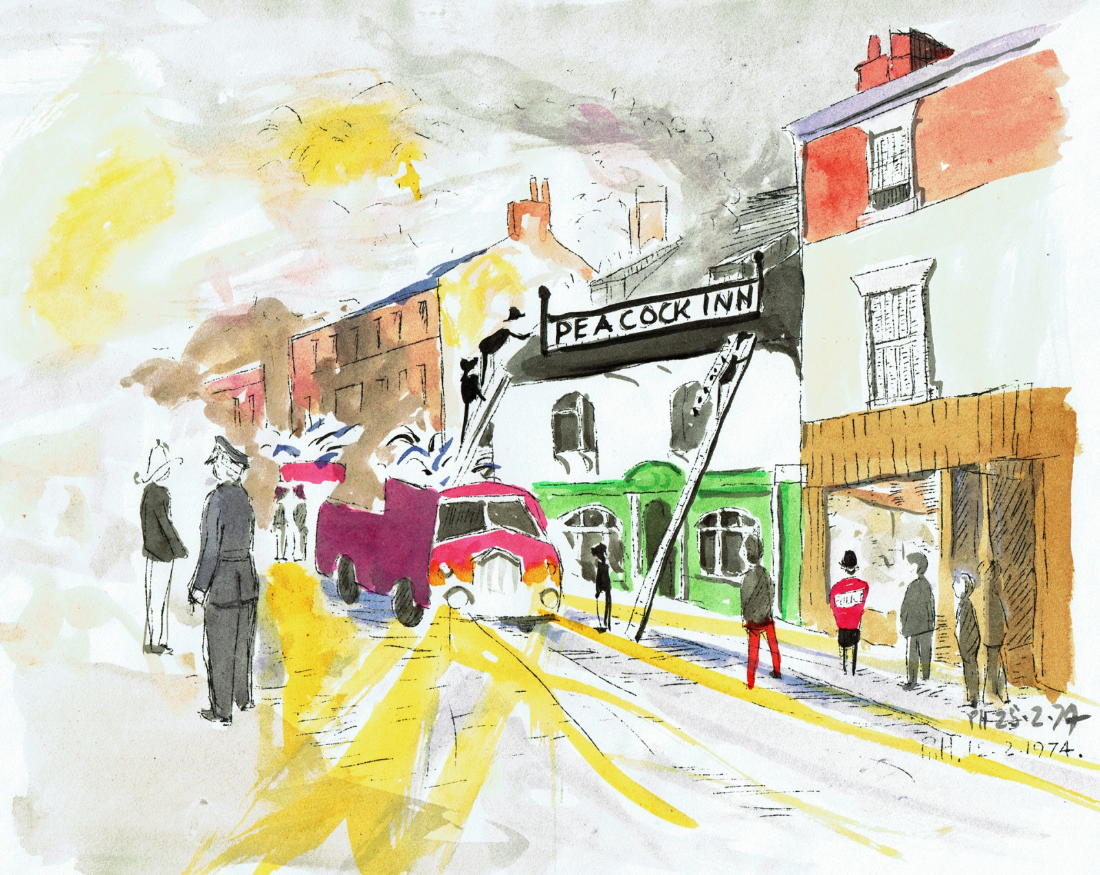
And this was the image it replaced. Perhaps best described as ‘folk art’ it’s taken from one of a series of ‘newsletters’ that the late Phyllis Hanson produced, mainly for her friends. This marks the day when the former Peacock Inn, Low Pavement, caught fire in 1974 revealing the historic timbering on the upper floor, which ultimately led to its conservation.
Our former Chairman Peter Maycock has let us have some photographs he acquired during his involvement with the society.
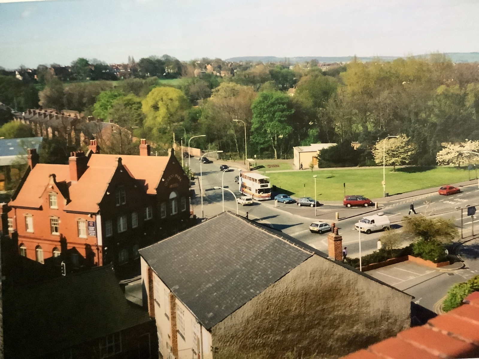
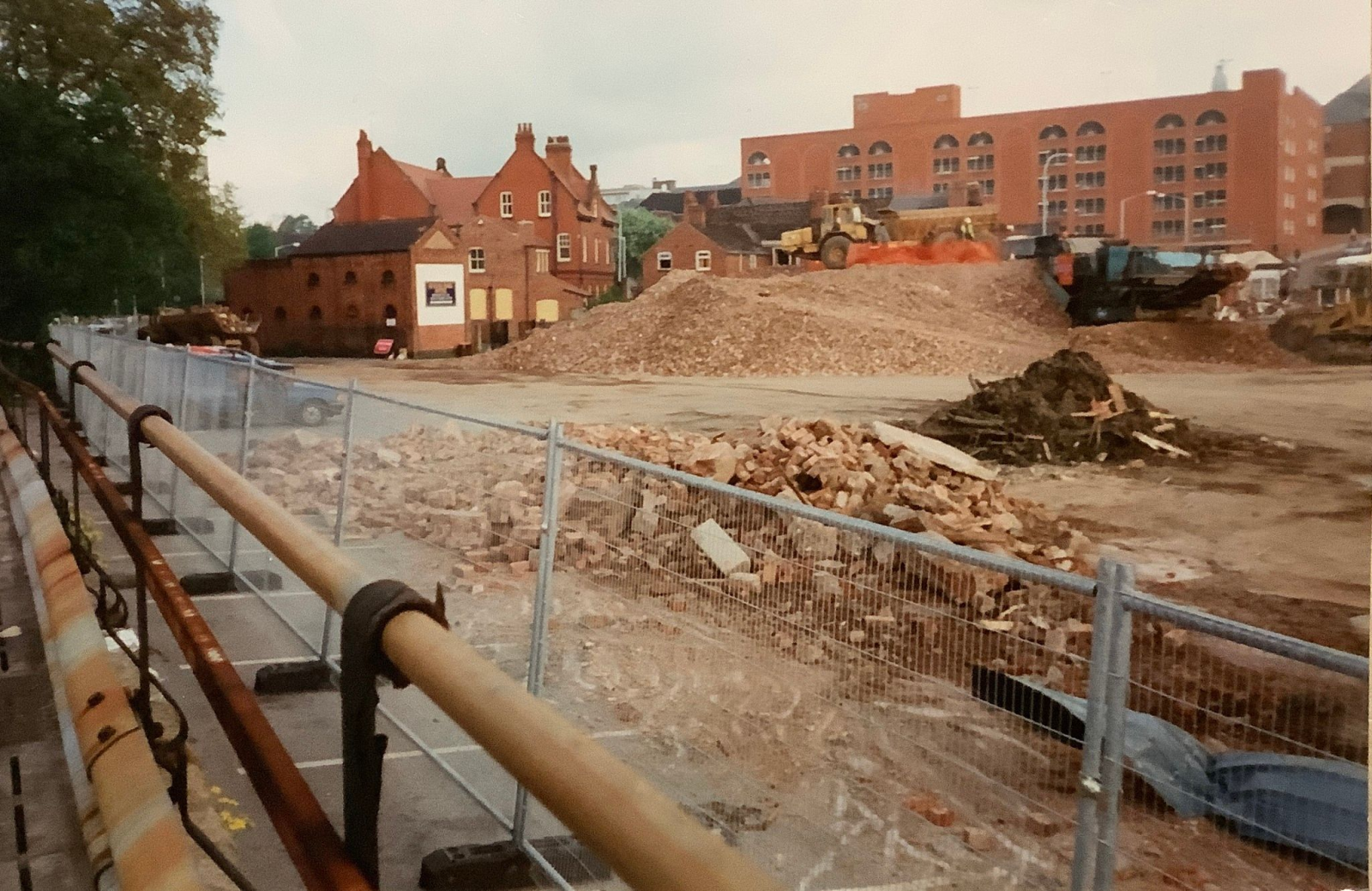
(PM1) Our first photograph was taken before demolition of the much lamented Queen’s Park Hotel (left). This was demolished literally overnight, in May 1997, when, it is thought, the developer got wind that the borough council wanted to list it and prevent demolition.
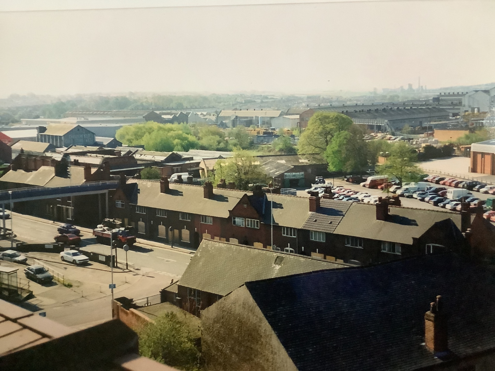
(PM2) This photograph shows the terraced housing on Markham Road, with what used to be the cattle market (opened in 1900) behind. This was being used as a car park at the the time and was linked to the town centre by the grey and blue bridge to the left. The Ragged School is to the bottom right, with what is now the Coach Station to the left.
You might also be able to make out the Tube Works to the distant right and on the horizon the Avenue carbonisation plant.
The Ravenside Retail Park now fills most of the area to the centre left and right of this photograph. Another pre-May 1997 view.
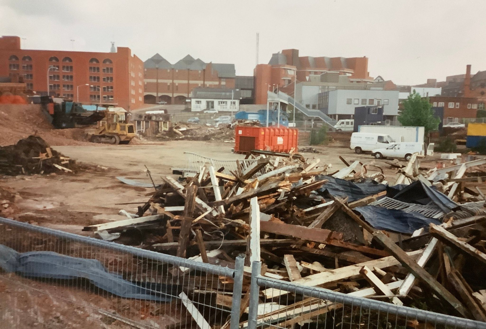
(PM3) We’re still in the same area as our previous two photos in this next series of four, but this time our photographer is taking a look across the former cattle market, up towards Markham Road, as demolition of the buildings take place.
The Queens Park Hotel is to the left in this photograph; The Pavements car park is to the right of centre. The Queens Park Hotel was demolished in April of 1997 – so this series must be before that.
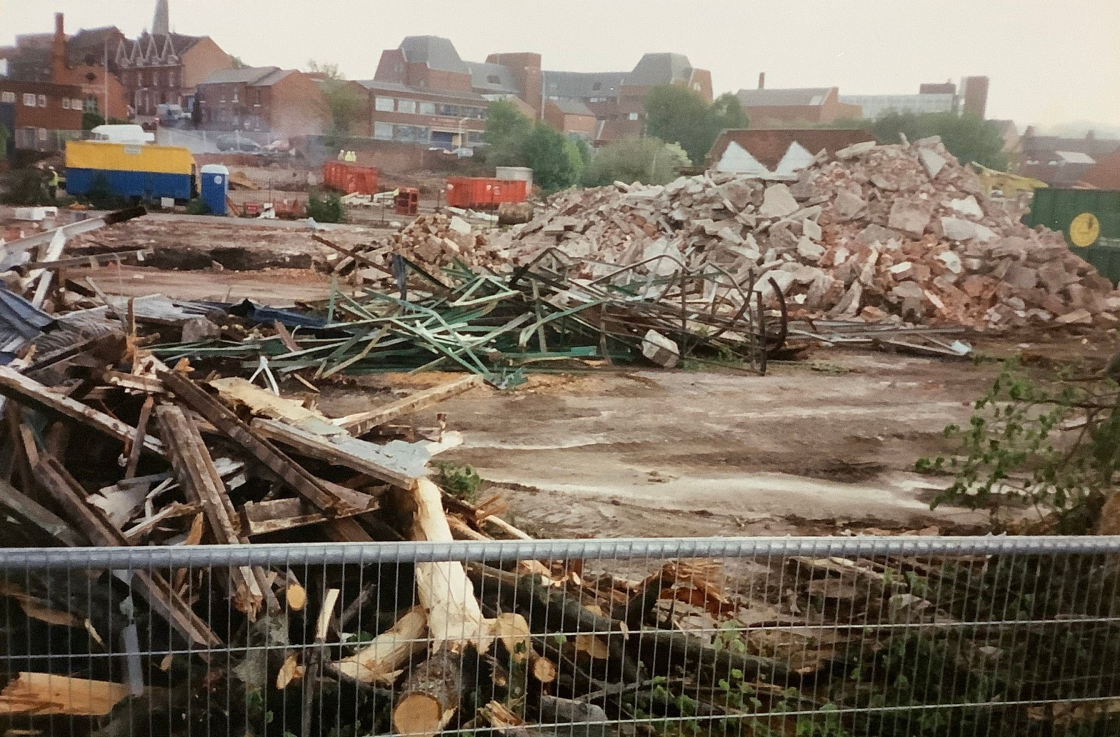
(PM4) The old East Midland bus station and waiting building is just left of centre in this image. Note the truncated bridge we mentioned in our last photographic post. You might just be able to see the old Corporation Slipper Baths building to the extreme right, just above the yellow and blue site cabin with its chimney- it’s to the top left on the next photograph.
(PM6) The old slipper baths are to the top left, just behind the old South Place public toilets – also now demolished. Perhaps surprisingly all the terraced houses on South Place itself still survive.
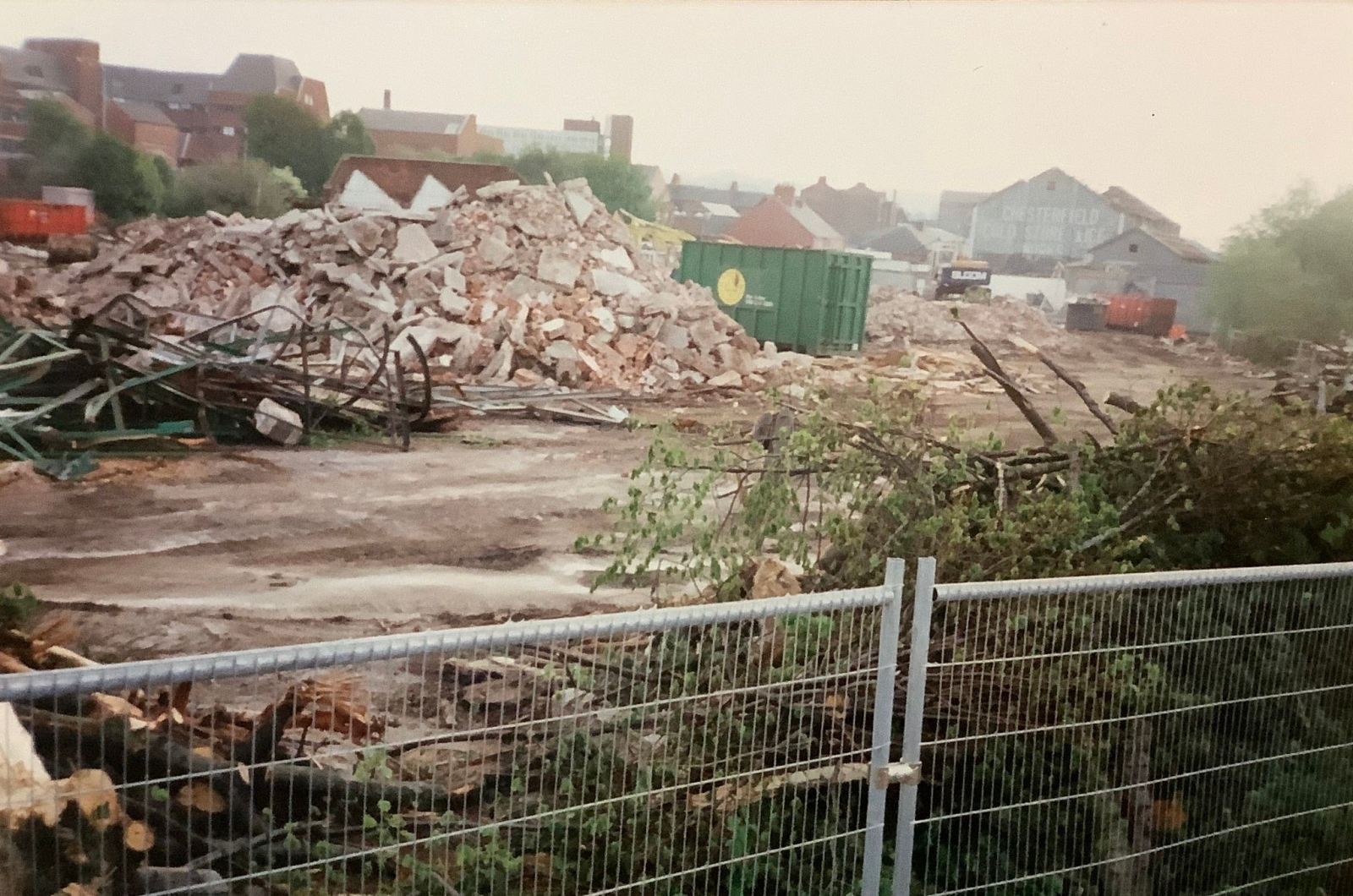
(PM7) Finally, to our fourth and last offering in this series. The Beetwell Street police station is to the top left. The grey building to right was, as the writing on the gable end says, the former ‘Chesterfield Cold Store & Ice Works’.
1997 doesn’t seem that long ago – does it? But in the area covered by these four photographs housing, the old Hipper Street School, the Markham Hostel, Salvation Army Citadel, cold stores, cattle market, corporation abattoir and the popular Queen’s Park Hotel are all now gone and replaced by a retail park.
We had a very interesting talk by Alan Foster, senior partner in the well-known Chesterfield estate agents WT Parker, as part of our 2022 meetings programme. With his permission have been able share some images from various sale catalogues he showed us at the meeting.
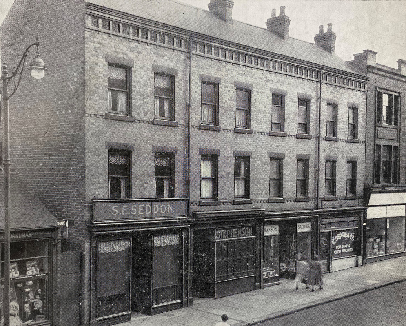
F1) Numbers 17, 19, 21 and 23 Cavendish Street were for sale in November 1949. Co-incidentally one of shops (behind the two women) was Hanson’s saddlery – where Phyllis Hanson worked with her father. To the far right is the Cavendish Street entrance to the Stephenson Arcade. This was a once well-known Chesterfield shop, selling toys and gifts. One could walk straight through from Cavendish Street, to a similar looking entrance on Stephenson Place.
The property was for sale by auction on behalf of the Eyre family who owned a sustainable part of this area, including the Stephenson Arcade and, of course, Eyre’s furniture shop – another Chesterfield institution, which closed its doors in 2022.
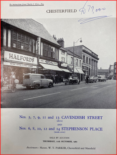
F2) Another block of Eyre family property in Stephenson Place and Cavendish Street was for sale in October 1962. This front cover of the auction catalogue shows the Cavendish Street property. The written ‘£79,000’ indicates the final sale price.
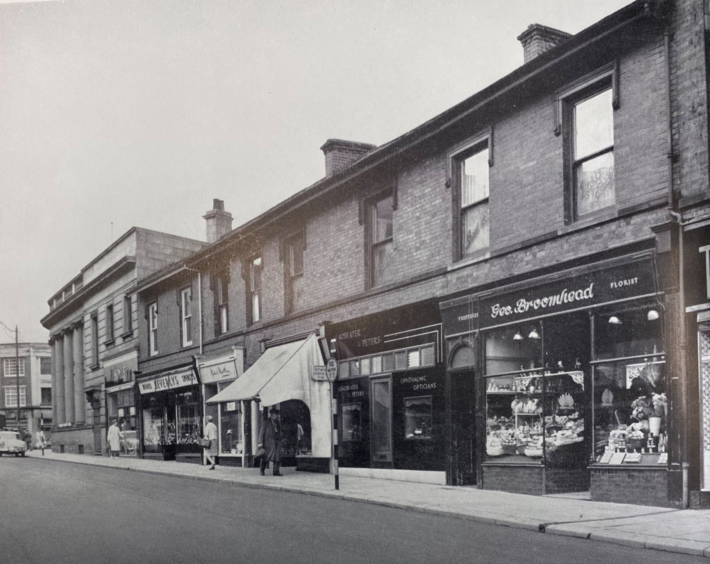
F3) This view shows October 1962 auction’s Stephenson Place property. As in Cavendish Street the sale did not include the shop – Hoyles – situated at the ground floor of the later Royal Bank of Scotland (RBS) – then William’s and Glynn’s Bank.
Hoyles was another shop which had frontages to both Cavendish Street and Stephenson Place. They sold women’s fashion wear, particularly dresses. All these buildings, of course, still survive, though the RBS closed in 2022 and is currently (September 2022) empty and for sale.
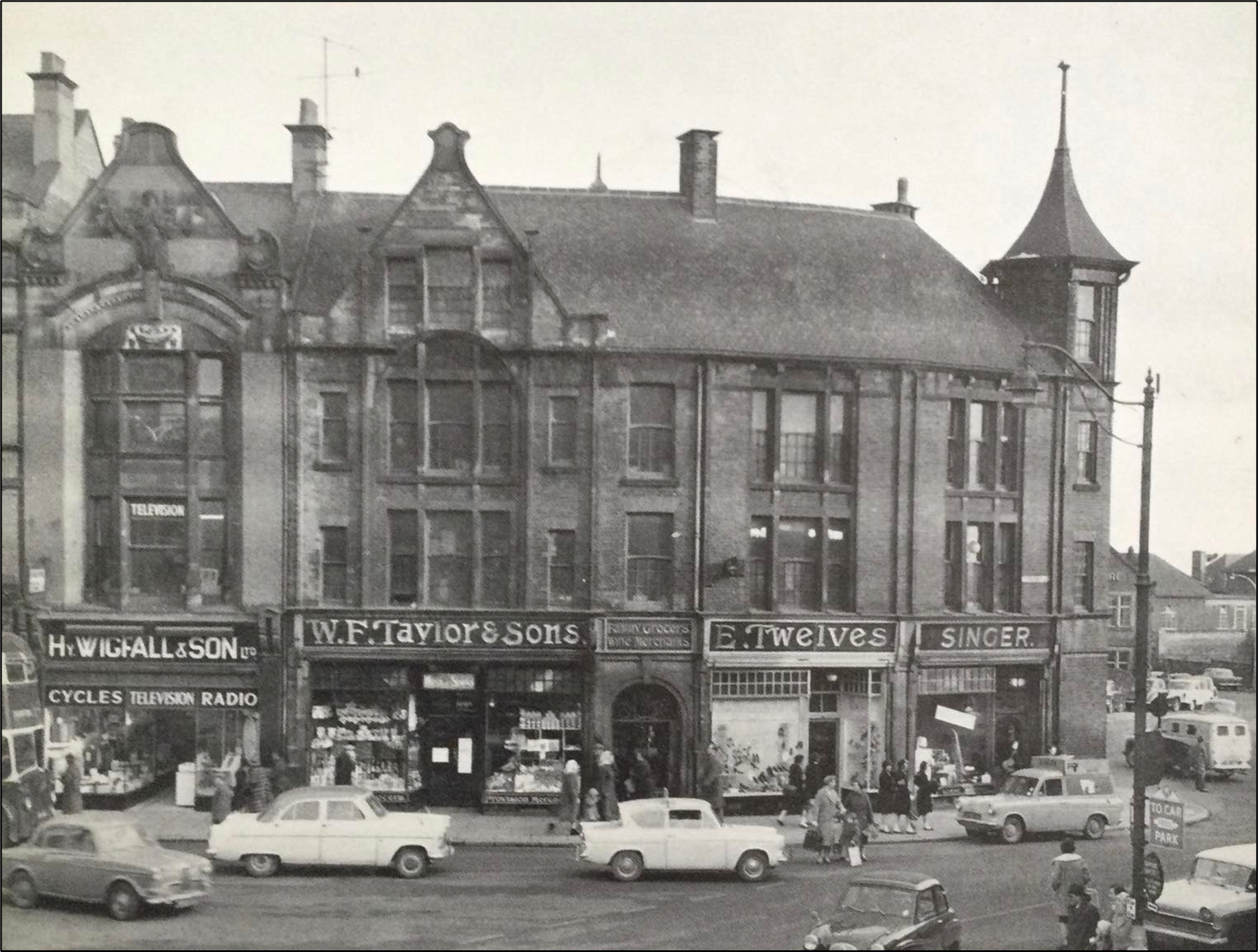
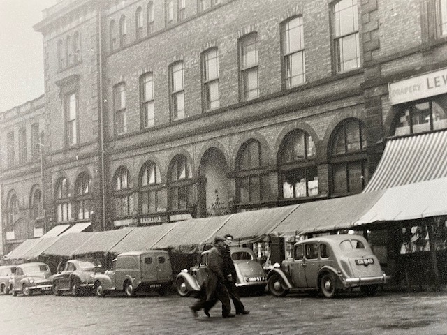
F4) May 1962 saw 1, 3 and 5 Stephenson Place for sale by auction. We won’t comment too much on the variety of shops, suffice to say that it’s a wonderful everyday Chesterfield scene, with a sprinkling of shoppers, signpost to a free (!) car park (to the extreme lower right) and what would now be vintage cars all over the place. Even a Chesterfield Corporation Leyland Titan double decker bus just gets in the picture (on the left), for this was once a very busy bus stop area.
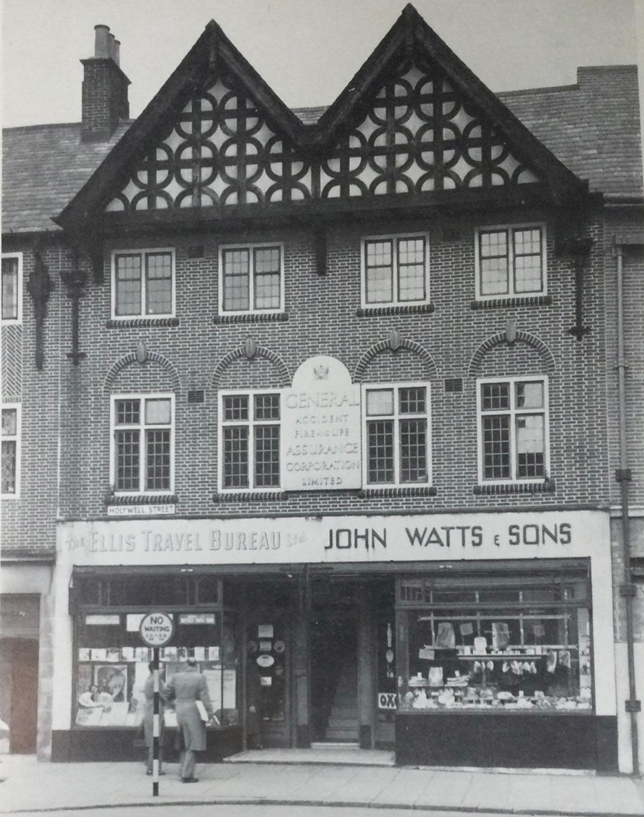
F5) January 1957 saw these two properties 27 and 29 Holywell Street for auction. From the photograph it looks as though John Watts & Sons were butchers, but they weren’t listed in the Borough’s 1959 directory. But Ellis Travel Bureau lasted much longer. This family run company would now be styled travel agents. They were the only such business in Chesterfield for some years. There’s an article about this business in the Newsletter for November 2016 which you can download from the newsletter page here.
John Watts became the Wimpy Bar. It’s now (September 2022) a drinks bar.
The centre stairway goes up to the offices of General Accident, who later moved to a former house on Saltergate – now Inspire Health. These were the days when you visited a local office to make an insurance claim – now it’s all on-line.
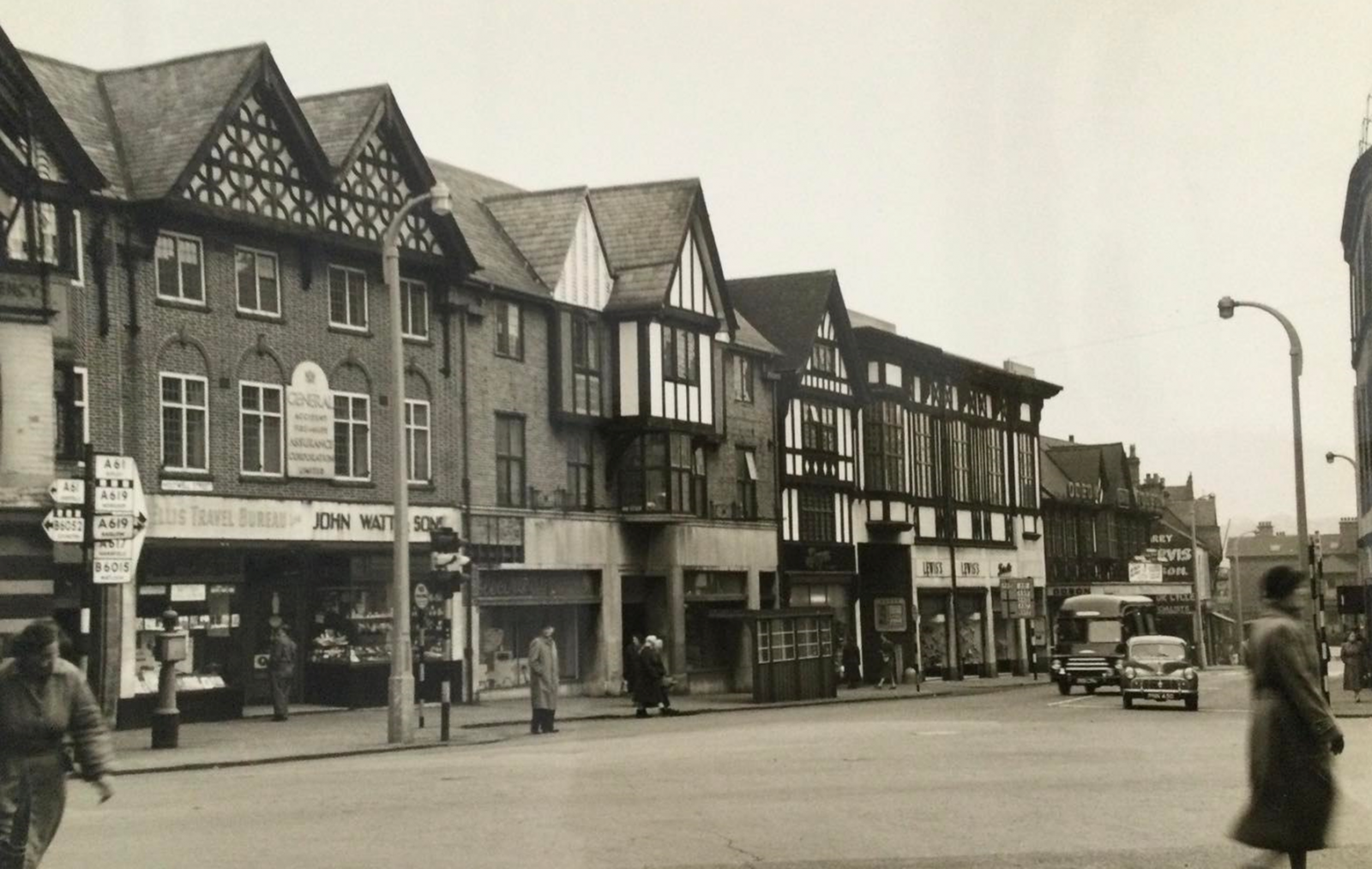
F6) Presumably another photograph taken in conjunction with the January 1957 sale of 27 and 29 Holywell Street, but there’s much of interest on this view. Behind and to the left of the once standard Chesterfield cantilevered bus shelter (which would be painted green and cream), is the former Chesterfield Corporation Electricity showrooms at 23 Holywell Street. On nationalisation of the electricity supply industry in 1948 it became the service centre of East Midland Electricity Board. Here you could pay your electricity bill in person and select a range of electrical goods, including cookers and refrigerators. We are not quite sure what is happening to the shop front boarding, by the way.
To the right of the showroom is the Odeon Ball room, with shops at ground floor, followed by the original Picture House building. The Picture House cinema opened in 1923 but was enlarged in the 1930s. That decade it was bought by the Odeon Cinema chain. It closed in 1981, but is now the borough council’s entertainment centre – ‘The Winding Wheel’.
To the extreme right of this photograph are the premises of Eyres furniture shop, which closed in 2022. This long-running business had originally been established in 1875.
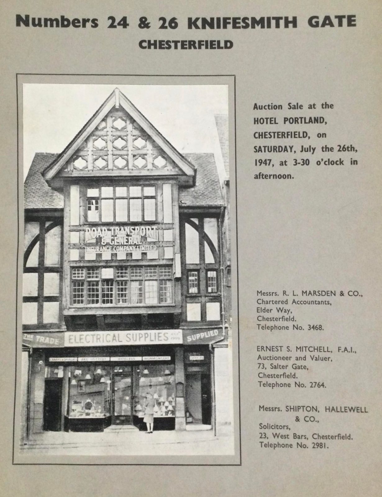
F7a) Another insurance company with a local office – Road Transport and General – were on Knifesmithgate at the time of this auction sale in 1947.
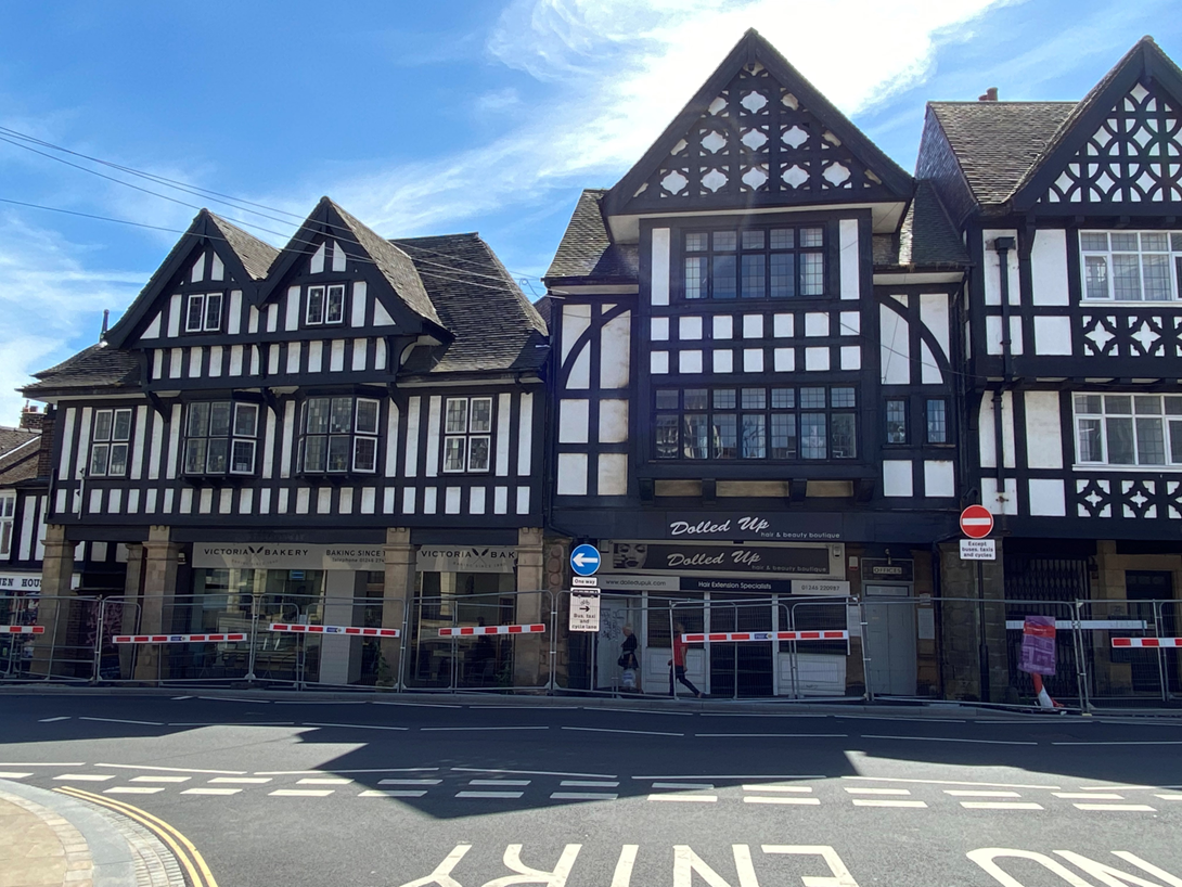
Prior to Alan’s talk we had a little difficulty in identifying this property, but a quick look at an Ordnance Survey map and a site visit soon identified it was still with us, as the 2022 photograph below shows.
F7b) Our 1947 auctioned property is to the right of centre in this photograph – opposite the junction of Knifesmithgate with Elder Way. Somehow it doesn’t look quite as quaint as the auction catalogue photograph, but is a fairly typical Chesterfield ‘black and white building’.
For many years number 26 was Camerathorpe, who sold cameras, photographic and cine camera film, records and cine cameras themselves. In the 1947 auction photograph it’s the premises of Electrical Supplies Ltd. We think that the sign board says they were established in 1909. The shop was also Frank Yates, jewellers, for many years.
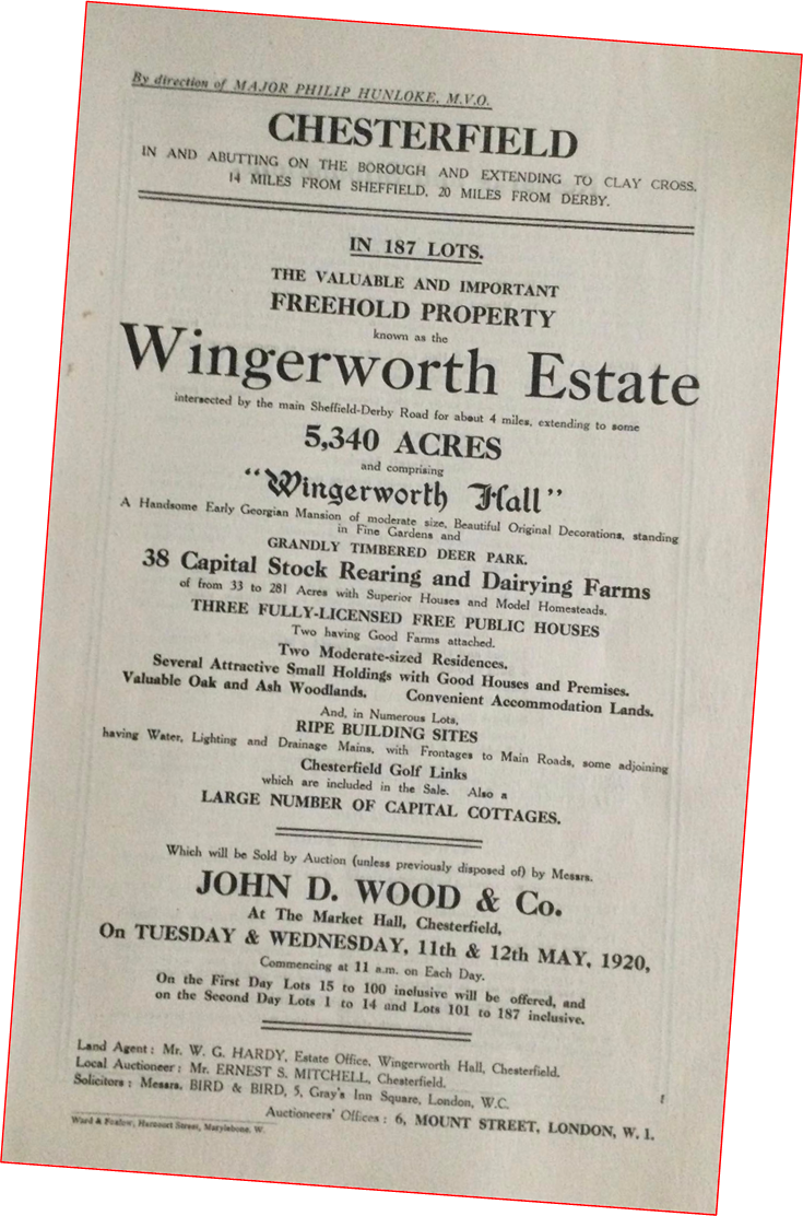
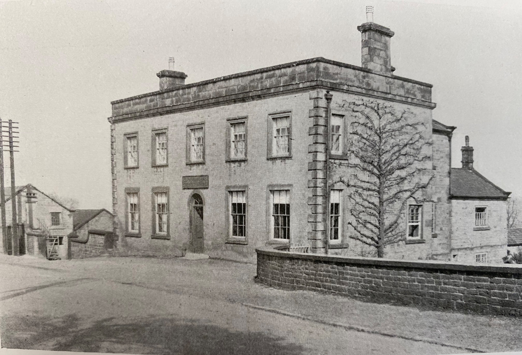
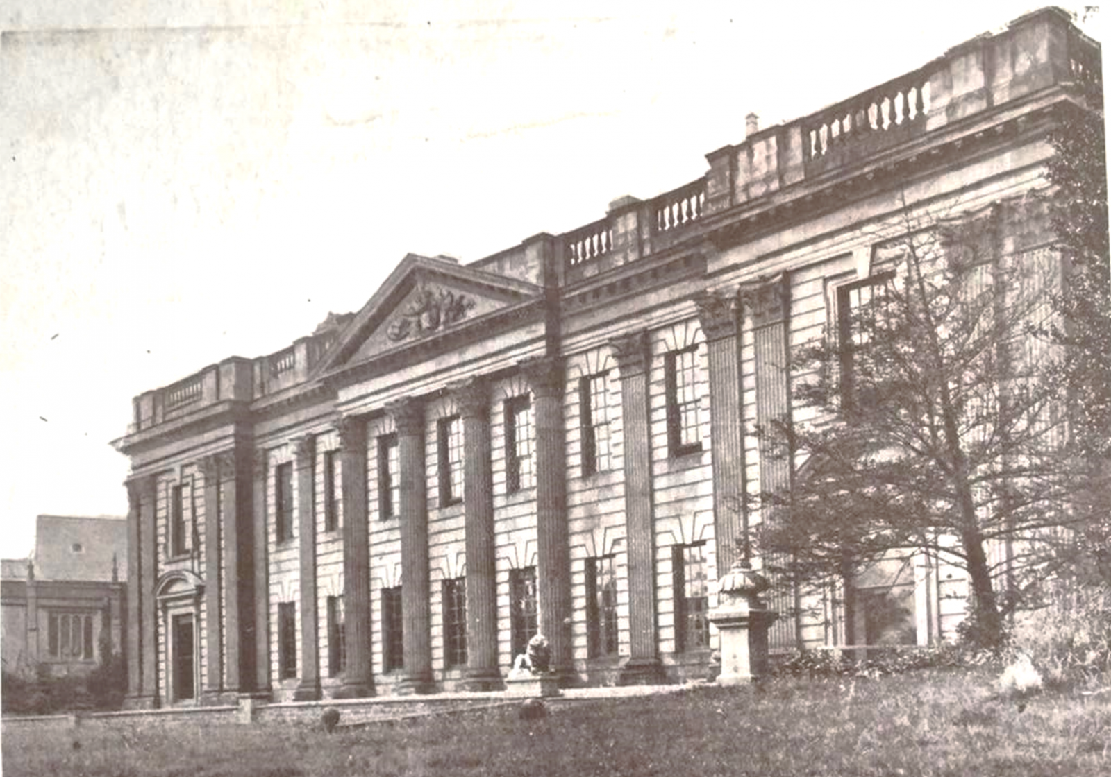
F8) Alan also brought along a copy of the Wingerworth Hall auction sale catalogue, held in May 1920, to the meeting. The hall itself was not sold. A further attempt to sell it also failed and it was eventually dismantled by Wm Twigg of Matlock. Some of the fine interiors were salvaged and exported to America. Read more about Wingerworth hall here. The following photographs are taken from the auction catalogue.
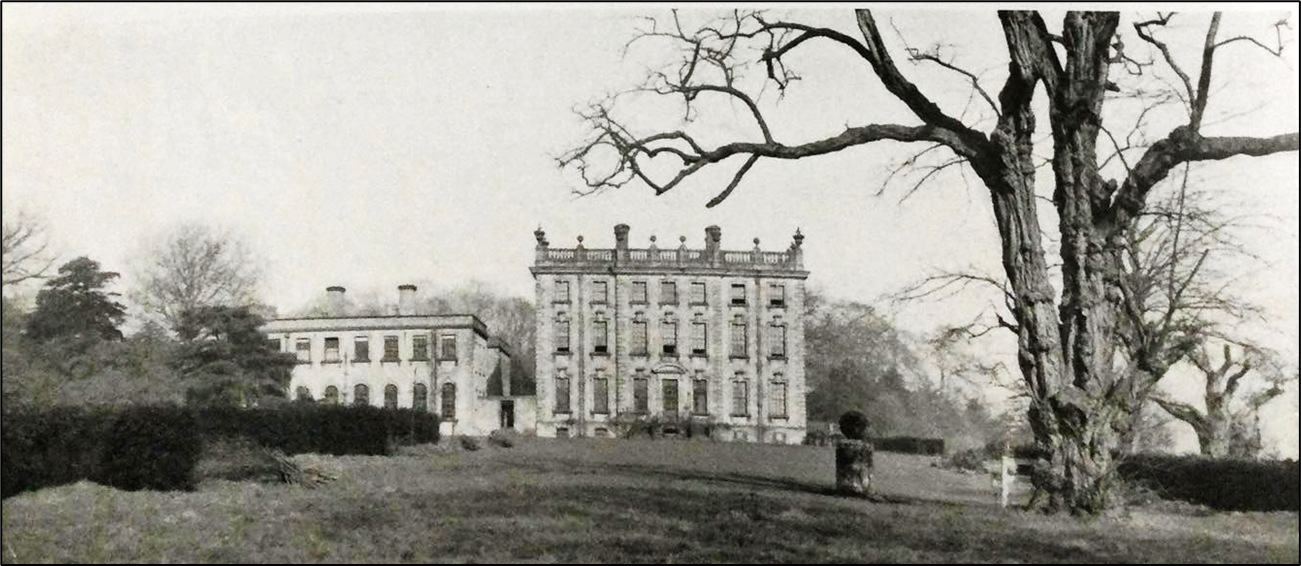
F9) The south front. Part of the Hall does actually survive though these are the two service wings one of which can be seen to the left of the main hall.
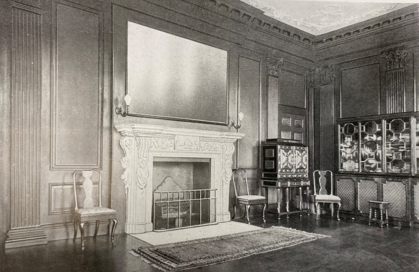
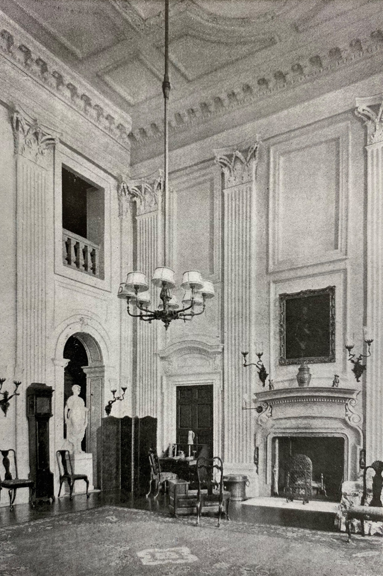
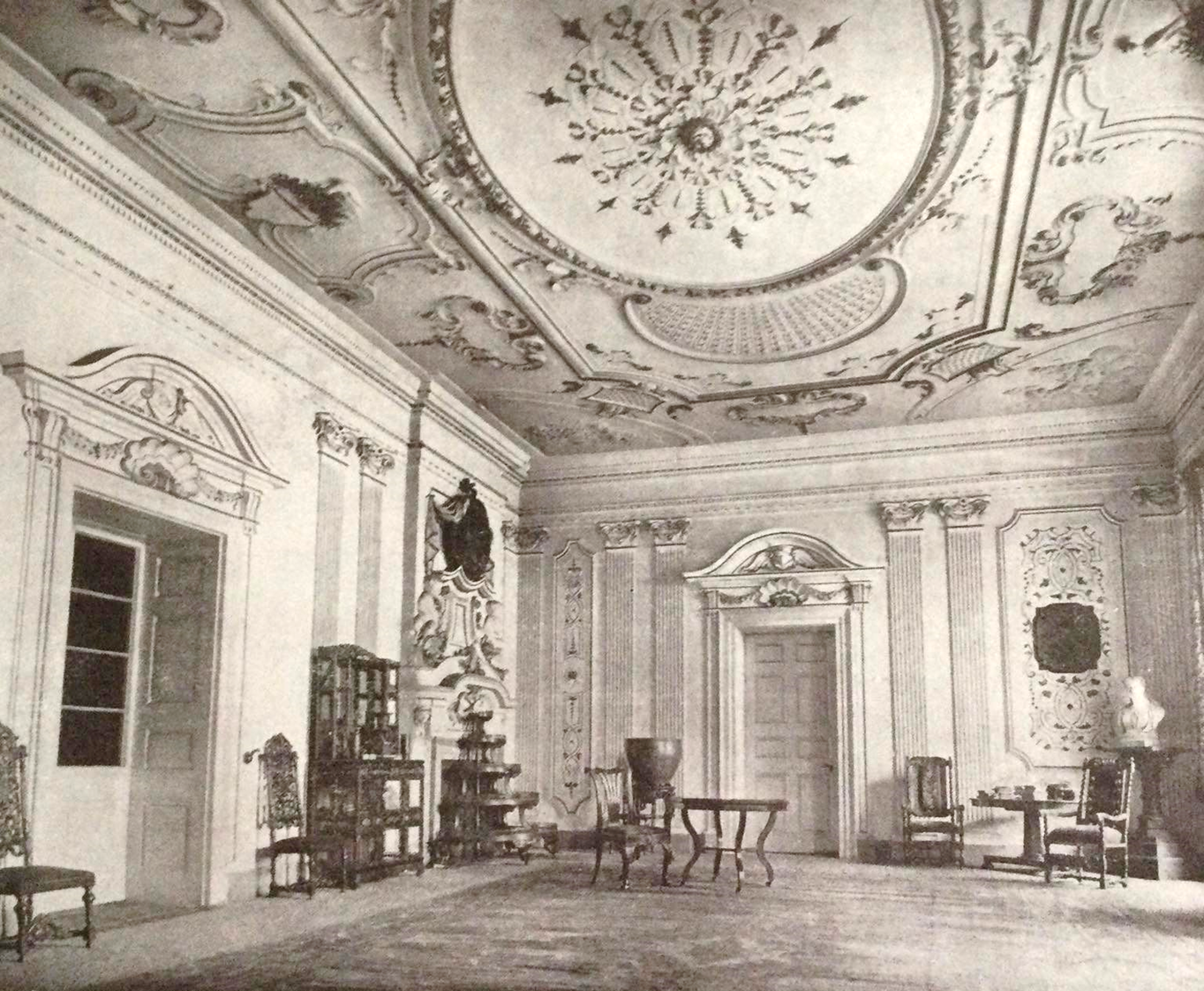
F10) ‘The Oak Drawing Room’ – the fireplace still survives in America.
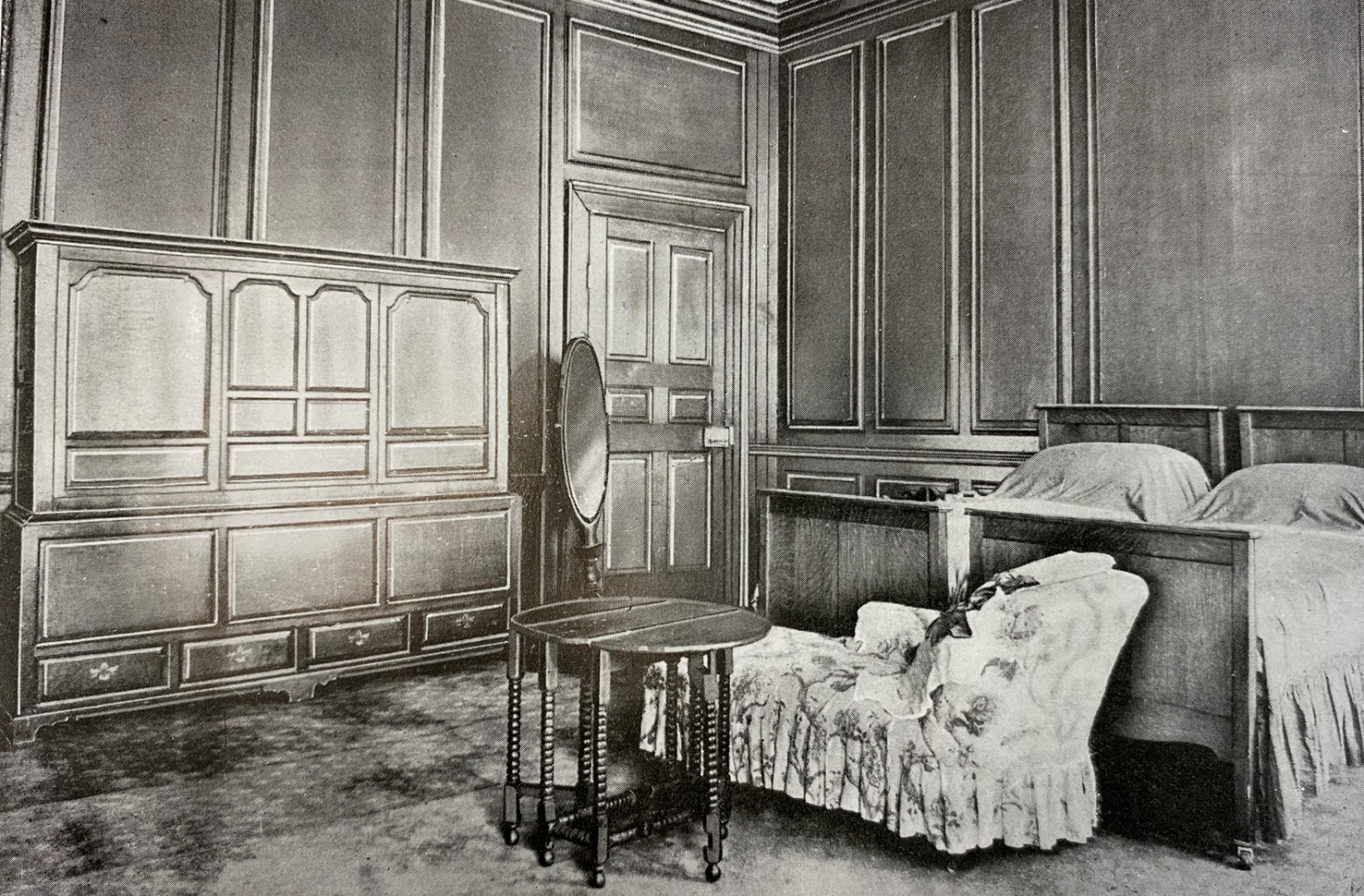
F11) Described as a ‘typical bedroom’.
F12) The Saloon.
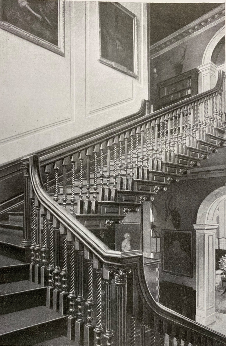
F13) The Staircase. Hundreds of English country houses were demolished after the First World War. Sadly, Wingerworth was not the only one locally – Brimington Hall succumbed as did Sutton Scarsdale Hall, the latter now reduced to an empty shell, the former gone completely. Along with Wingerworth Hall, both these properties saw architectural salvage, with some rooms exported to America.
F14) The Hunloke Arms was lot 7 in the Wingerworth estate sale. It still survives as a popular eating venue.
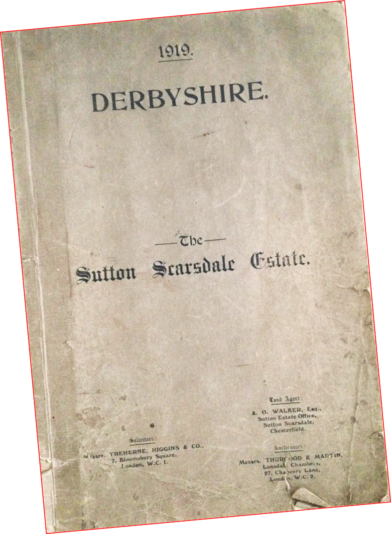
F15) Perhaps a better known sale was that of the year before Wingerworth’s – the Sutton Scarsdale estate. Here much property was for auction, but like Wingerworth the Hall remained unsold.
F16) From the auction catalogue; ‘The Hall – East Front’. The story is well-known that the building was originally sold to a consortium who stripped the house – with some interiors being sold as architectural salvage, ending up in America, being purchased by museums and for film sets.
Equally well-known his how Osbert Sitwell (from Renishaw Hall) came across the shell, (just about to be demolished) and purchased it. For more about the history of this fascinating place – the shell of which you can visit today – see here
F17) The entrance hall, from the auction catalogue. Fragments of the plasterwork in this room still exist inside the hall. The present owners English Heritage have recently spent some effort in trying to stabilise the hall and its remains.
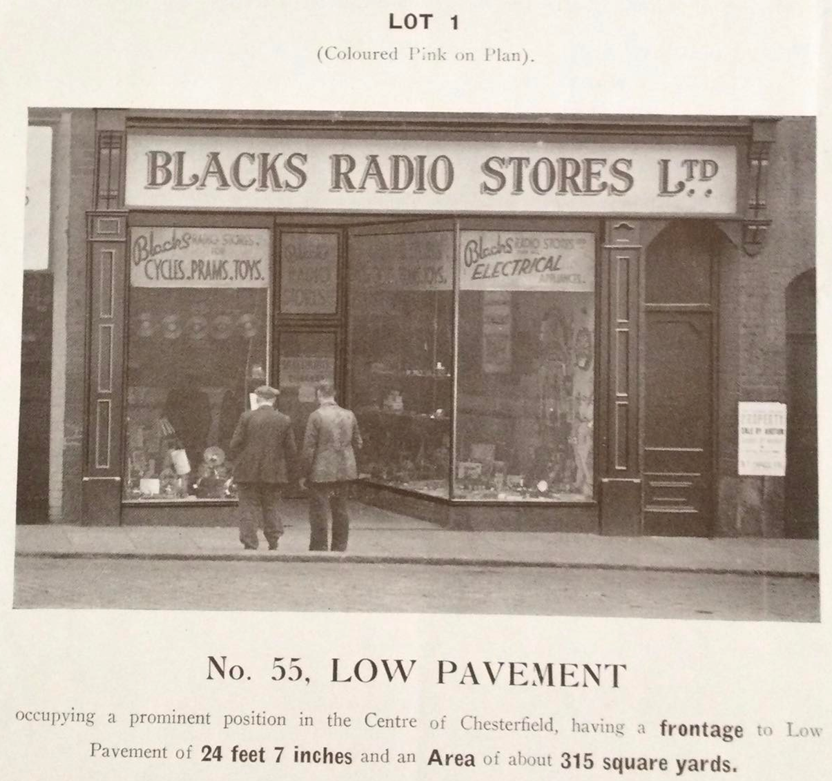
F18) Back to Chesterfield town centre, where in 1947, 55-63 Low Pavement were for sale by auction.
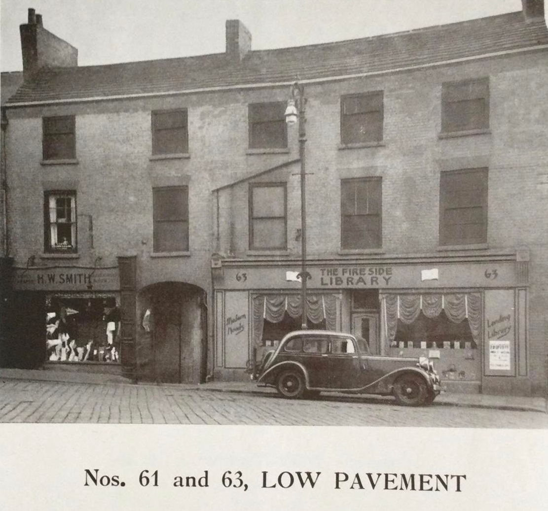
F19) Lot 2 was 61 and 63 Low Pavement, which included ‘The Fire Side Library’ – which was a lending library (of books) – in the days when it was fairly common for such establishments – Boots chemists also ran them nationally. The drapes in the windows must have taken some arranging!
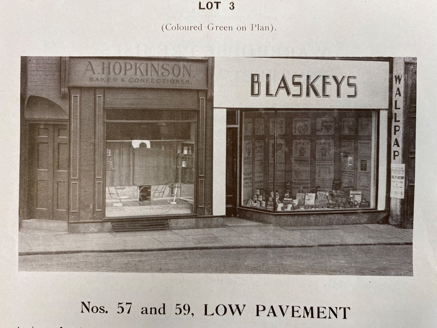
F20) Finally, lot 3 – 57 and 59 Low Pavement. Blaskeys were a well-known wallpaper shop, who survived up until the 1980s refurbishment of Low Pavement and construction of the Pavements shopping centre behind the façades. It’s a sobering thought, but in 1959 there were eight wallpaper merchants selling the stuff in the old Chesterfield borough – with six of these in the town centre alone.
F21) A 1965 view of the New Square end of Low Pavement. Note the unfortunate man on wooden crutches with one leg and the traffic light. For the town centre was open to all vehicular traffic at this time. The Peacock Inn, the subject of Phyllis Hanson’s painting above, is to the left of the photograph.
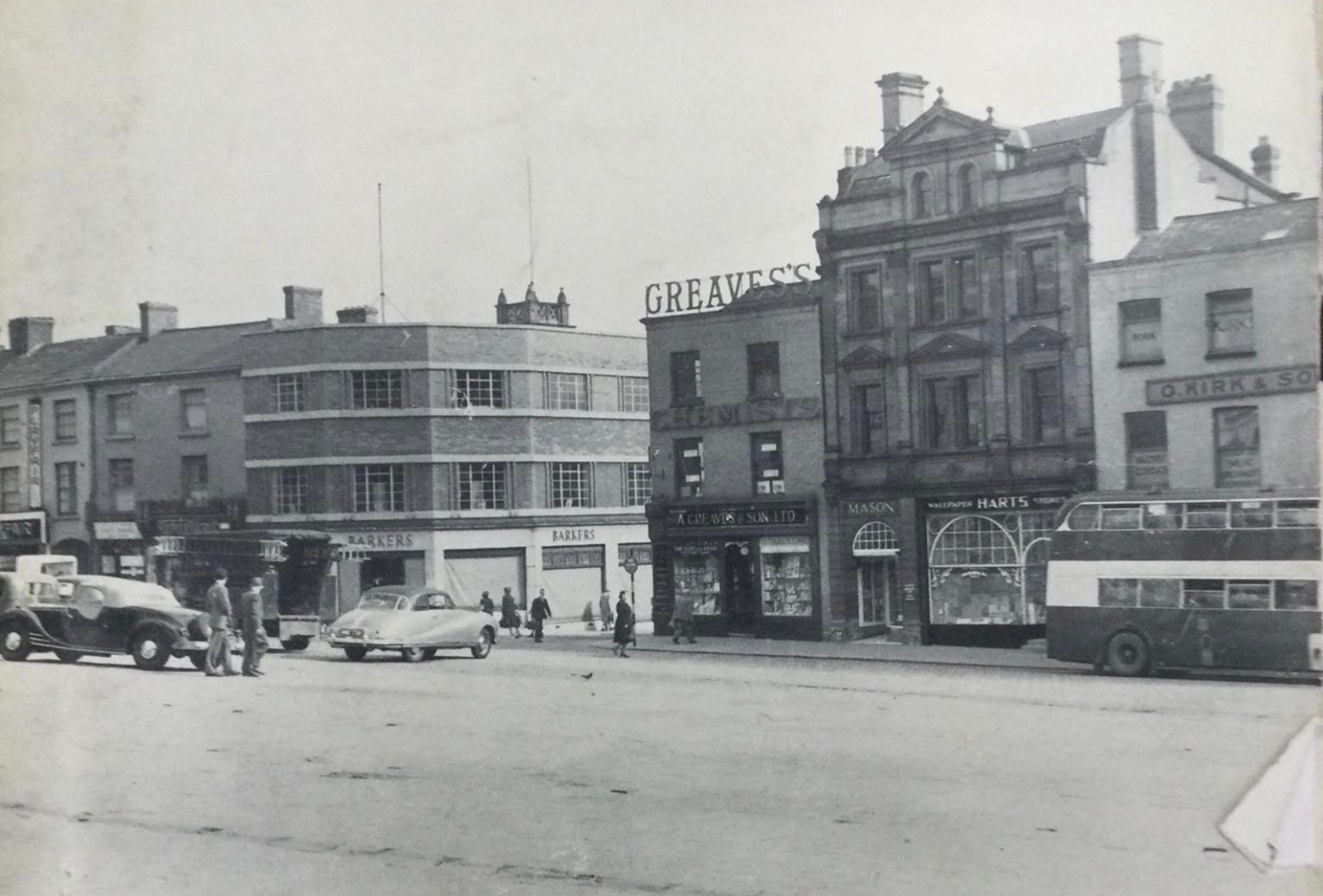
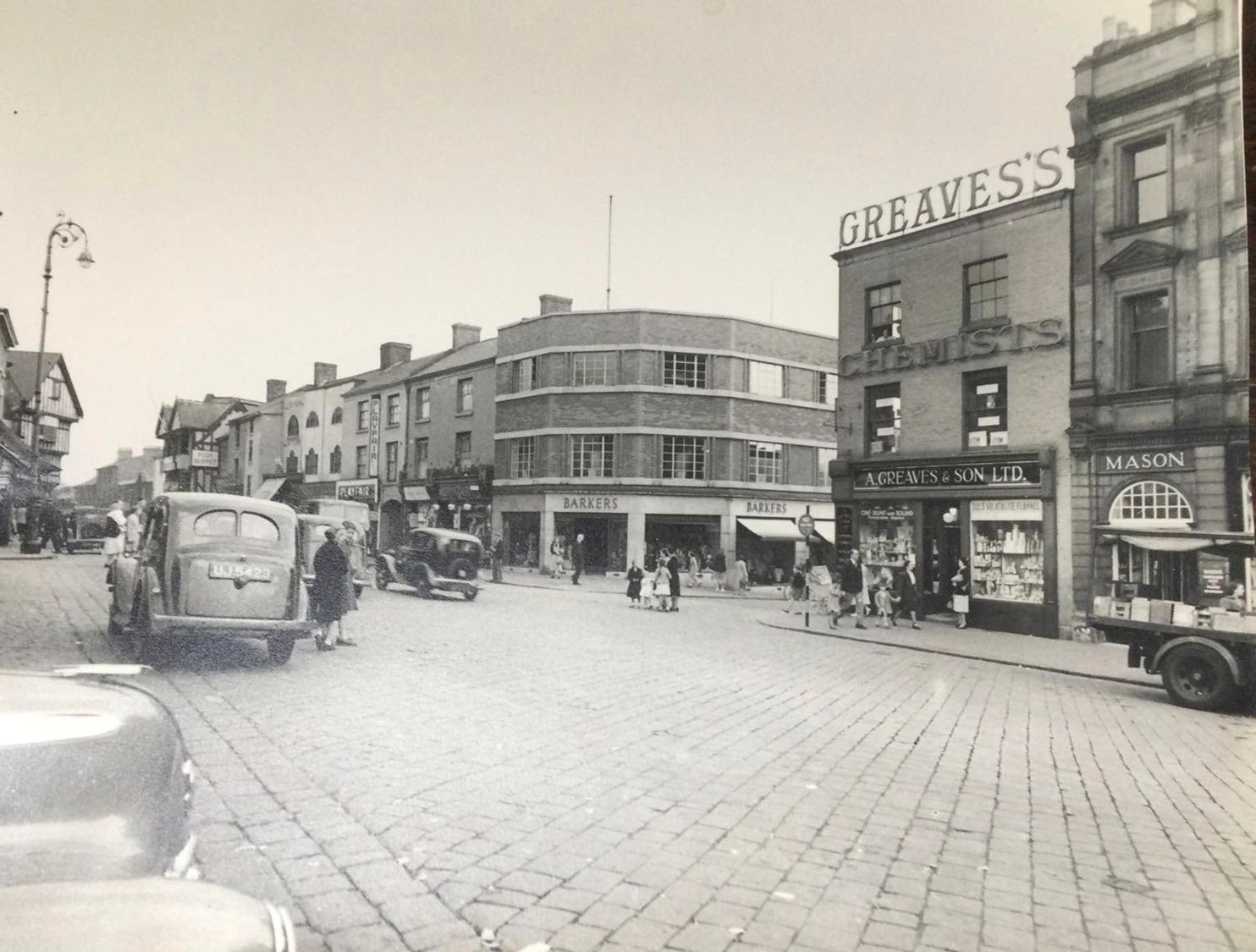
F22) 1952 and the premises of Greave’s chemists were for sale, which prompted a photographer’s visit for the auction catalogue. Here the stalls have been cleared for car parking in the Market Place.
Greaves were a well-known chemists who moved to Vicar Lane when they had to vacate their extensive Low Pavement property due to the town centre redevelopment. Boots now occupy their site.
Kirks were pork butchers – their speciality were warm pork cobs. Hart’s were wallpaper sellers, in competition with Blaskeys who weren’t that far away. FW Mason – in the small shop between Greaves and Harts – were tobacconists. They also, at one time, had premises in the Market Hall.
We’re not quite sure who Barkers were. The premises ended up being Harris Carpets before Tontine Road, which ran between Greaves and Barkers, was stopped up. The building now houses McDonalds.
F23) Slightly further along Low Pavement, but looking more towards Central Pavement. John Turner’s corner can just be seen to the left. The remnant of this traditional department store still remains. Beneath it now sits Costa Coffee.
We still think that this is 1952, but it was obviously taken on a much busier day than our previous view. Note the lamp standard to the left, with its distinctive bracket top, which we’ve adopted as our logo. There’s still a few around the Market Place area and they are listed.
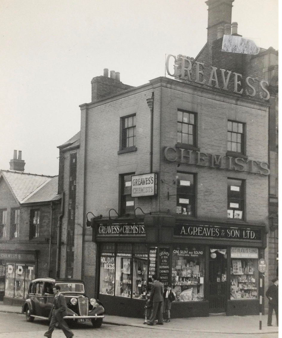
F24) A closer view of A Greaves & Son’s premises – we think the date is still 1952. Greaves used to widely advertise that they had been established in 1836.
The famous (at least in Chesterfield) long-window is above the car. This illuminated an internal staircase and was designed to minimise payments of window tax. The window was removed when the premises were gutted to become part of The Pavements shopping centre. It was intended that it would go back in, but it was found to be so rotten that it had to be discarded. There is, though, a replica of the window in a similar position today, though largely ignored by passers-by.
You might be able to make-out the letters ‘DDT’ spread across the three windows in the shopfront to the left. This will no doubt signify that Greaves were keen suppliers of Dichlorodiphenyltrichloroethane, commonly known as DDT. This was originally developed as an insecticide, but it became infamous for its environmental impacts and was later banned world-wide.
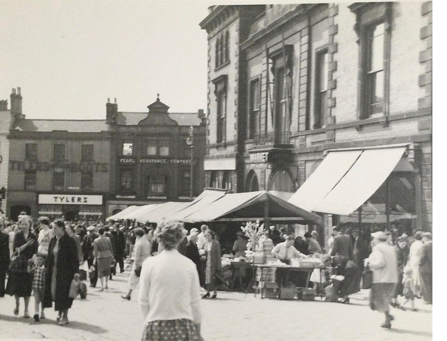
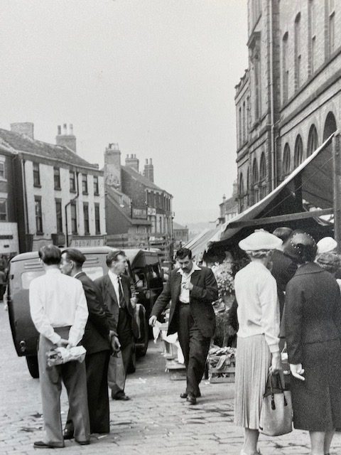
F25) The first of a few views around Chesterfield Market Place. We don’t think that these were used in auction catalogues, so are unsure why they were taken. But never-the-less they give a picture of a busy town centre, possibly around 1952, some taken on different days. In this view we are looking down towards Low Pavement on a market day. It’s notable how thronged the town is with shoppers – in the days before internet shopping and supermarkets. The Market Hall, designed by Davis & Sons, was first erected by a private company in 1857. It was later extended with a corn exchange facing into New Square.
F26) The front of the Market Hall is to the left and we’re looking up towards Glumangate in the opposite direction of our previous photograph. On the coroner of the latter and the Market Place is the old Westminster Bank, demolished and replaced by the present building in the early 1970s. Lewis’s (to the left) were drapers. Notice how flat the cobbles appear.
Architectural historian Nikolaus Pevsner was not impressed by the Market Hall which he described in his 1953 ‘Buildings of England’ book as ‘the crudest show of High Victorian provincial prosperity’.
F27) Turning round, our unknown photographer captures the Low Pavement side of the Market Hall. At this time vehicular traffic was very much part of the town centre scene – the widespread pedestrianisation of today was some years off.
F28) This view was taken on a different day to (F27) in this series, as the vehicles are different, and it looks more overcast and less busy. Nor does it look as though the stalls are in use.
Notice the gap in the windows above the two men. This was a side entrance to the Market Hall.
At one time Chesterfield had half day closing, when most of the shops would close after dinner on Wednesday. At one time market days were only on Monday and Saturday.
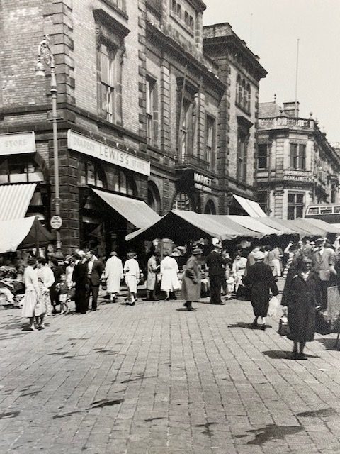
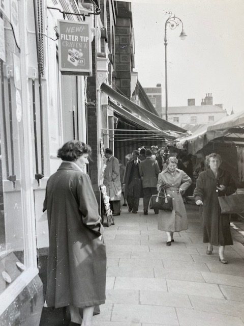
F29) A wonderful conversation piece, full of everyday, now vanished details. In this view we are looking back towards Lewis’s shop, on the Low Pavement side of the Market Hall. The projecting sign ‘New Filter Tip Craven A’ is an advertisement for a once-well known cigarette brand. Notice another one of the lamps, from which we have taken our CADLHS logo.
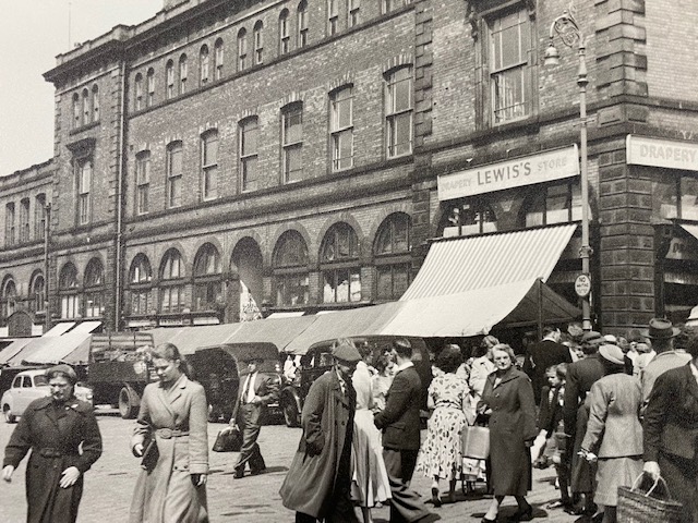
F30) For our final 1950s view in this series around the Market Hall we are again looking along the Low Pavement elevation. The Peacock Inn is the middle distance, just left of centre. The market appears to be in full swing and it looks a little warmer than in some of our previous views.
This whole area was once threatened with a series of comprehensive redevelopment plans, but fortunately the majority of the buildings in this photograph were eventually saved, following adoption of a more conservation-based approach to the town centre redevelopment in 1976.
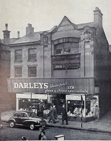
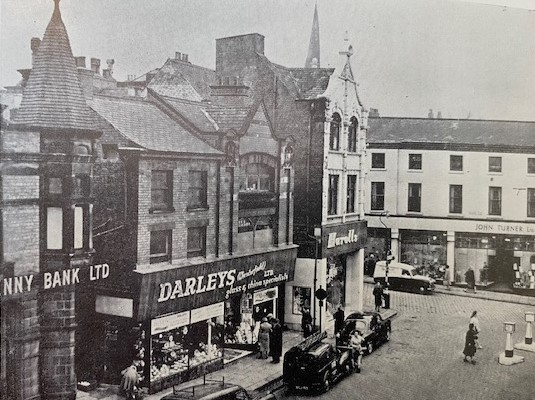
F31) The premises of Darleys (Chesterfield) Ltd were for sale by auction on 18 January 1961 by WT Parker. This is actually number 10 Central Pavement. China and glass specialists Darleys are not listed in the Borough of Chesterfield Official Directory of 1963 so presumably went out of business at some stage following the sale.
F32) Another 1961 view of Darleys, but of a wider angle. Yorkshire Penny Bank, latterly the now closed Halifax Building Society, is to the left, Harolls to the right. To the far right is part of the frontage of John Turner Ltd.
Just in front of the van you might just be able to see the lamp standard to what was Chesterfield’s first gas lamp (though by then converted to electricity). The standard is dated 1824 and can now be found in the parish church, churchyard. First sited at the south-east end of the Market Place it was later moved to the position in this photograph. It was designed by Joseph Bower, who apparently made the gas and piped it to the nearby lamp from the cellar of the now demolished Cathedral Vaults public house on the Market Place.
Our thanks to Alan for allowing us to share these photographs and the extracts from auction catalogues. Some of these may not have been seen before or have not seen ‘the light of day’ for many years.
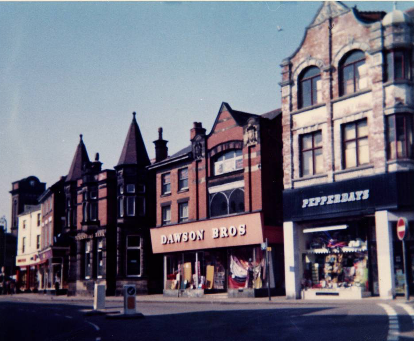
(PC1) Perhaps coincidentally Philip Cousins had this view to show us in his talk on 1970s Chesterfield to our October 2022 meeting. It shows Central Pavement in 1974. Dawson Brothers, who sold linen, were occupying the former premises of Darleys by this time, with Pepperdays, who sold toys, now trading from the former premises of Harrolls. (Courtesy and copyright of Philip Cousins).
(PC2) We are looking at the other side of Central Pavement from that above, again in 1974, in another of Philip’s talk photographs.
Hardy’s shop on the corner (they sold furniture and carpets) is now McDonalds and the highway the premises fronted to the right – Tontine Road – is now stopped up, pedestrianised and used as the entrance to the library and The Pavements shopping centre.
Most of the buildings in this photograph survive – including the prominent building on the left – John Turner’s corner, but those in the right far distance, beyond the projecting building of what was then Boden’s fish and chip restaurant, were all demolished as part of the Vicar Lane shopping development. (Courtesy and copyright of Philip Cousins).
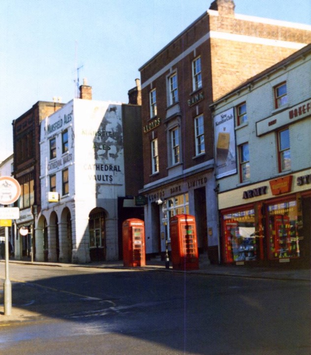
(PC3) This 1974 view of Chesterfield Market Place shows the Cathedral Vaults public house and Lloyds Bank (relocated since then at which time it became a branch of the TSB, but is now (2023) closed and empty). To the right is Wakefield’s army stores, who sold surplus ex-force’s equipment, along with tents and the like. Next to the Cathedral Vault’s (sadly demolished in 1976) is the also now demolished Lipton’s (as it then was). Lipton’s closed as was taken over by the adjacent Boots branch who used the ground floor for baby clothes and equipment. The top floor was rather haphazardly accessed from the the adjacent Boots. Records, cassettes, etc were primarily housed in this extension. Notice the red telephone boxes – nearly all now disappeared. (Courtesy and copyright of Philip Cousins).
(PC4) How many people stopped off at Mason’s Buffet, the red and white building seen to the left here on New Beetwell Street? By the time of this 1974 view the business had moved a little to the right, off photograph. The site is now covered by The Pavements shopping centre. Beyond, after a shot gap by the now stopped up Tontine Road, is the Chesterfield (one time Borough) police station – now covered by the central library. You might just be able to make out the police ‘Panda Cars’ parked outside the garage area. (Courtesy and copyright of Philip Cousins).
(PC5) Just beyond Mason’s Buffet was the end of Greave’s chemist property, followed by Tontine Road, which ran to the side of the police station (to the right in this photograph). This area is now covered by the central library, particularly the steps leading up from New Beetwell Street, whilst Greave’s is covered by The Pavements shopping centre, but with its Low Pavement frontage retained. In this 1974 view the Cathedral Vaults can be seen just above the man to the left, in the Market Place. The former furniture store of Hardy’s – to the left of the second man – is now McDonalds. (Courtesy and copyright of Philip Cousins).
(PC6) Nicknamed by many as ‘The Donut’ the car parking area bounded by Saltergate, the Saltergate link road and Holywell Street was created after widespread demolitions finally in the 1970s. The link road opened in July 1973. The photographer is stood on the site of the then yet to be constructed Saltergate multi-storey car park. The blue hut that might just be seen on the open air car park, to the left of the street light, was an RAC centre. This is a summer 1974 view. (Courtesy and copyright of Philip Cousins).
Our thanks to Philip Cousins for sharing these photographs from his talk ‘1970s Chesterfield’ with us.
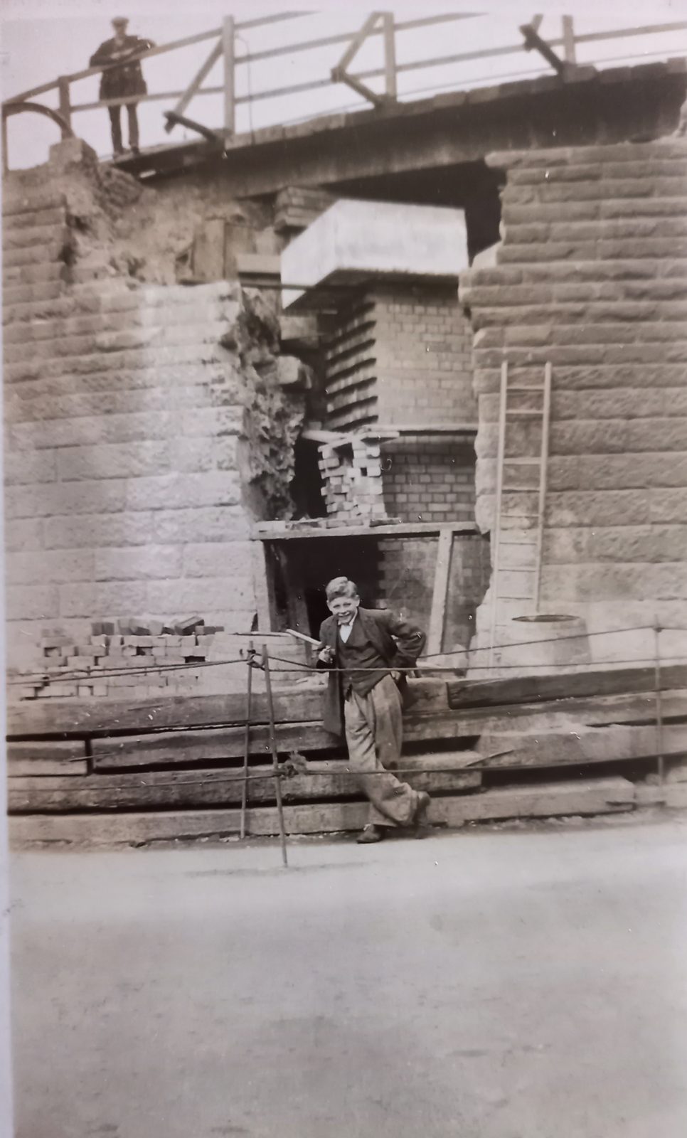
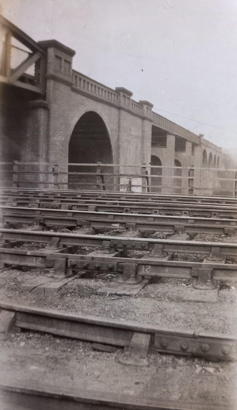
We think that these next three photographs were taken during reconstruction of the former Midland Railway’s Horns Bridge structure in 1932.
As is generally well-known; three railways crossed in the vicinity – the Midland Railway, the former Lancashire, Derbyshire and East Coast Railway via its Horns Bridge Viaduct and the Great Central Railway. You can’t see the latter on these photographs. Of these only the former Midland route (earlier the North Midland Railway) remains – it’s the current main line to London via Derby.
Thanks to our secretary for these photographs which we don’t think have been published before.
(CT1) The bridge deck of then London, Midland and Scottish Railway under reconstruction in 1932.
(CT2) Who is the young chap here? We don’t know, but do any of our readers?
(CT3) Looking from the track of the then London, Midland and Scottish Railway to the Lancashire, Derbyshire and East Coast Railway’s Horns Bridge viaduct.
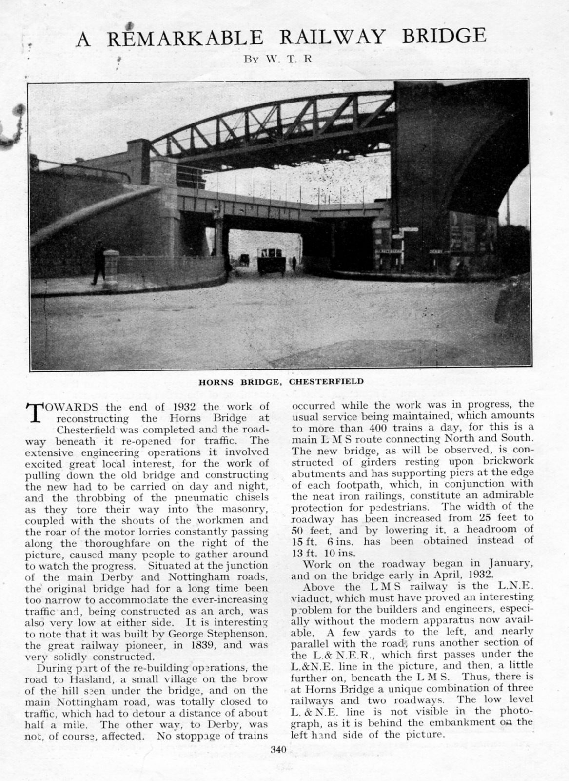
A page from the London Midland and Scottish Railway Magazine from some date in 1923 or 1933.
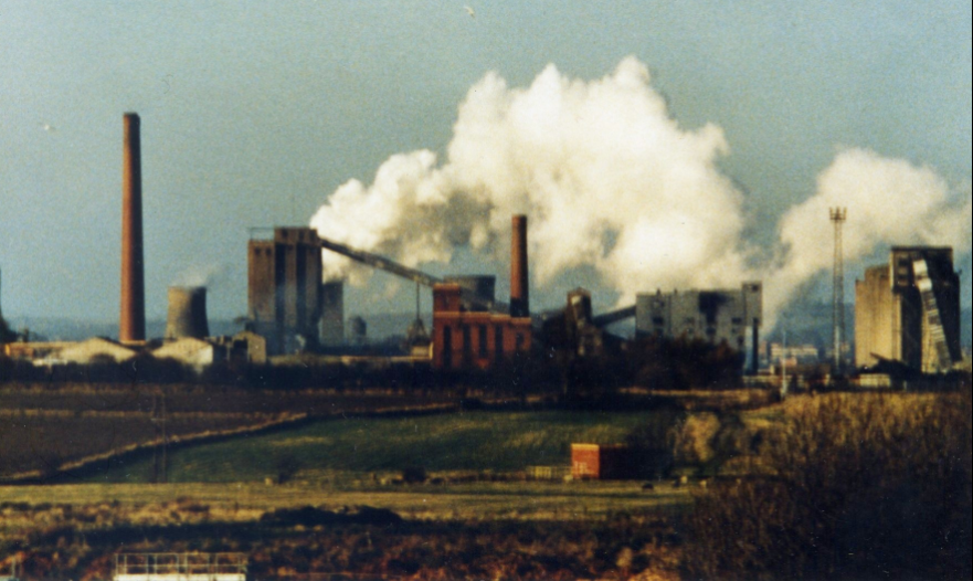
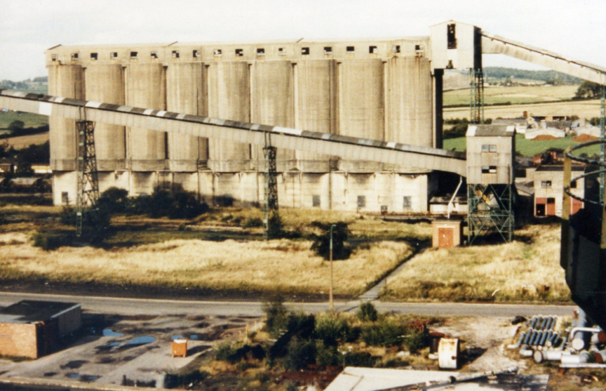
Here we present just a few of the late Alec Jackson’s photographs – he left these to the society and we are currently scanning and cataloguing them – but they will ultimately end up as a deposit in the Derbyshire Record Office.
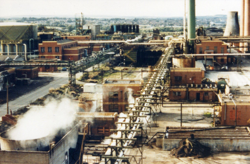
Avenue Coal and Carbonisation Plant, Wingerworth
Alec was fully qualified NCB trained electrician, who spent some time at Glapwell Colliery. He later moved to the Avenue Plant site where, we believe, he organised concessionary coal deliveries to miners and NCB Staff. It’s perhaps not surprising that the Avenue Plant, opened by the National Coal Board as a coal carbonisation plant in 1958, features in his photographs, alongside local collieries. The plant closed in 1992. We won’t detail its history here but if you want to find out some more head across to our article on the plant. (Our thanks to CADLHS members Meave and Peter Hawkins for the information on Alec Jackson).
(AJ1) A familiar site to many over the years was the Avenue site in full production. It made coke from coal and recovered by-products during the process, including gas and chemicals – some highly toxic. This view is taken from the Mill Lane area, perhaps in the 1980s/early 1990s. Before a long clearance and decontamination programme, it was once described as the most polluted site in Europe. It is now the site of housing and open space.
(AJ2) Blending bunkers (no date).
(AJ3) There’s no date for this but Alec has written on the back ‘Far left – salt house, booster house, gas holder, tar plant; bottom – E circuit cooling tower, effluent plant’.
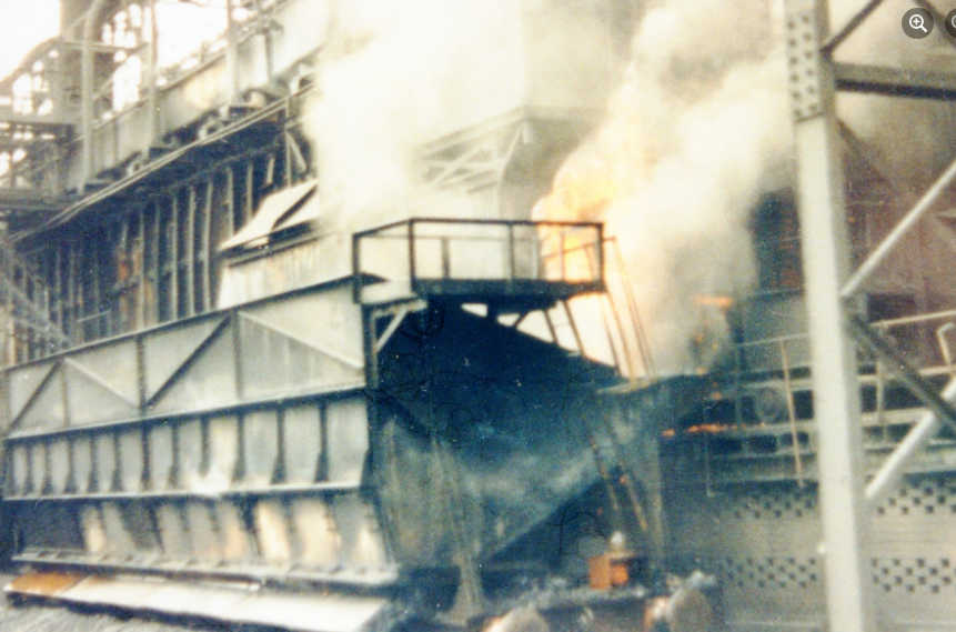
(AJ4) Alec has written on the back of this photograph ‘Last oven pushed approx. 1 pm, Wednesday Sept 16th 1992’. So this is probably the last official load of coal carbonised at the plant. But thanks to Brian Smith, who posted to Facebook we’re able to add the following: ‘This was officially the last oven pushed for the photographers and visitors but unofficially there were two more a few hours later when everyone had left. They had been kept in reserve in case this one didn’t work and I watched them being pushed and there was no one there with a camera to witness it.’
There’s more of Alec Jackson’s local coal industry images on this dedicated page here.
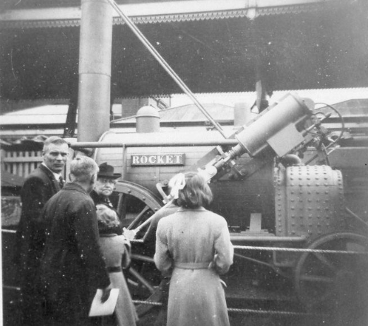
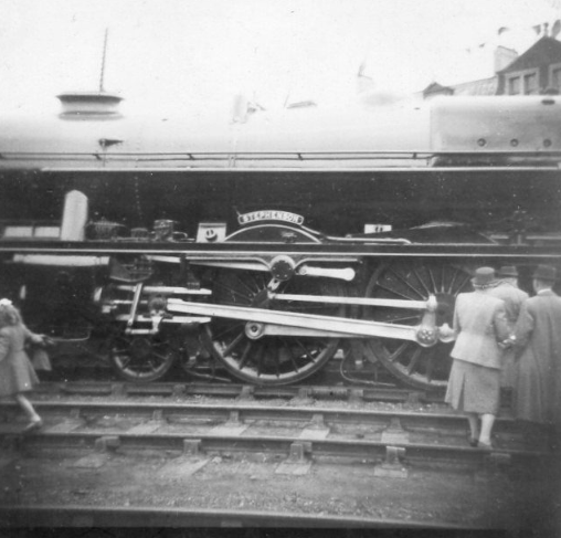
George Stephenson Centenary exhibition 1948
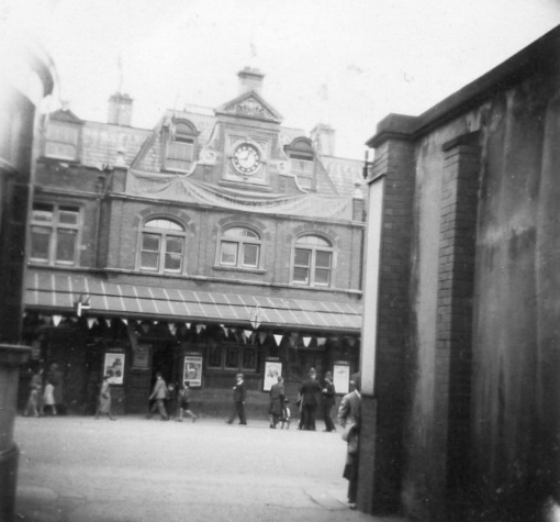
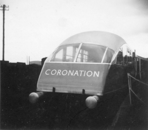
The next four photographs were taken by Alec in 1948 with his ‘box brownie’ – a relatively unsophisticated camera with a very basic lens. They show the railway exhibition held at the now demolished Market Place Station to commemorate the centenary of George Stephenson’s death (at Tapton House). There were a series of exhibitions throughout Chesterfield – but the railway exhibition seems to be the most well remembered and best attended.
Front of the Market Place Station during the exhibition. The station was situated next to the Portland Hotel, the latter being to the left (out of picture) of this photograph.
The exhibition mainly held in the station’s adjacent goods yard, brought together a creditable array of exhibits – particularly so as the railway had been nationalised at the beginning of 1948. This is the observation car of the ‘Coronation’ express train, which ran on the East Coast mainline.
A replica of the the ‘Rocket’ was a popular exhibit and is attracting the attention of on-lookers. The roof and valancing to the top of the photograph is to one of the platforms of the the Market Place station.
Our final photograph shows the newly named ‘Stephenson’ locomotive – one of the then up-to-date British Railways exhibits on show.
There is much more about the centenary exhibitions, including the railway exhibits in a special newsletter published in partnership with other local societies. To directly access this follow the link below, which will open a pdf download from Brimington and Tapton Local History Group’s website – one of our partners in producing the publication.